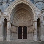
 Mapping Gothic France is a collaborative database project between the Visual Media Center at Vassar College and the Columbia University Libraries. The site presents an interactive map of France locating the major cathedrals and churches constructed between the twelfth and thirteenth centuries. Each architectural site is represented by high quality images and a short description. Panoramic views are also included, which allow you to experience each site as a “virtual visitor”. Another nice feature is the series of clickable plans included with each building record; these allow you to choose any location on the plan in order to explore corresponding images. In addition to the main locations map, several historical maps are included, which can be overlaid to explore changing medieval political boundaries.
Mapping Gothic France is an excellent image resource, and a vital research tool for students and scholars of Gothic architecture.