 The University of Oregon Department of Architecture has created two valuable web resources for examining the architecture and topography of 18th century Rome.
The Interactive Nolli Map Website, created by Jim Tice and Erik Steiner, presents a detailed, interactive map of Giambattista Nolli’s original 1748 plan of Rome. Using a Flash-based interface, users can zoom, pan and turn on various layers such as fountains, gates, walls and gardens. The map even allows you to overlay modern satellite imagery as a semi transparent layer, confirming the incredible accuracy of Nolli’s original map.
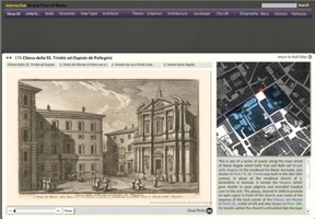
The second and more recent project is Imago Urbis: Giuseppe Vasi’s Grand Tour of Rome. This project builds on the Nolli Map project by integrating the work of one of Nolli’s contemporaries, Giuseppe Vasi (1710-1782). Vasi’s Grand Tour is a geo-database and website which displays and precisely locates over two hundred and forty of Vasi’s topographic prints within the digital Nolli Map.
Although these are not new projects, they are well worth a second look, particularly for those students taking Roman Urbanism this fall, or Rome in Situ in the spring.